Anadolu's Greenline environment news desk goes live in English


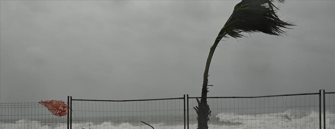
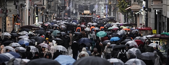
Cyclone "Harry," which affected Italy and Malta in late January, caused the flooding of many streets in coastal settlements in Sicily and Calabria, the collapse of roads, and serious damage to coastal infrastructures.
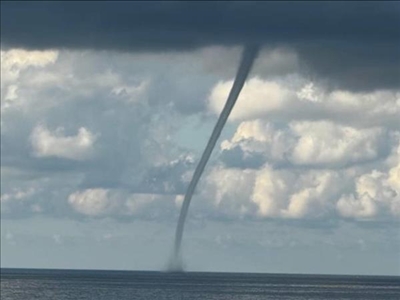
These types of storms, which have increased in both frequency and intensity in the Mediterranean in recent years, are referred to as "medicanes," derived from combining the first 4 letters of the word "Mediterranean" and the last 4 letters of the word "hurricane."
Sukru Turan Besiktepe, professor at Dokuz Eylul University’s Institute of Marine Sciences and Technology, told Anadolu that the increase in sea surface temperatures directly fuels such extreme weather events.
Stating that a regular temperature increase is experienced in both the atmosphere and the seas with the effect of climate change, Besiktepe noted that sea water temperatures throughout the Mediterranean have risen significantly since the 1980s and increased by an annual average of 0.04°C.
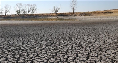
"From 1980 to 2025, the entire Mediterranean has warmed by around 1.6°C. The average sea surface temperature of the Mediterranean in summers normally varies between 21 and 24°C. The annual average sea surface temperature accepted as normal in the entire sea is 18.5°C. However, due to climate change, 2025 was recorded as the second-warmest year in the entire Mediterranean with an average sea surface temperature of 21°C, and 2024 as the warmest year on record with 21.32°C. These values were recorded as 20.97°C in 2023 and 20°C in 2010."
Besiktepe said July 2025, when the average sea surface temperature reached 26.9°C, was the warmest month ever recorded in the Mediterranean, stressing that sea surface temperatures in the region are rising around 20% faster than the global average.
Noting that sea temperatures hovered above 28°C for weeks due to marine heatwaves in some regions, Besiktepe said, " Exceptionally hot summers and insufficient cooling of sea water during winter strengthen the energy exchange between the atmosphere and the sea. This allows sea-fed storms like Harry to form more easily and become more intense."
"Forms in Western Mediterranean, moves east"
Recalling that storms of unprecedented intensity have begun forming in the Mediterranean over the past 20 years, Besiktepe described these systems as resembling tropical hurricanes but relatively weaker with shorter durations.
"These storms, known as ‘medicanes’ form by drawing energy from the sea, similar to tropical cyclones,” he said. “The higher the sea temperatures, the stronger the weather system it turns into when combined with the cold air mass. While wind speeds reach 200-300 km/h in tropical regions, wind speeds in these systems in the Mediterranean can reach up to 150 km/h."
Highlighting that these storms intensify especially as a result of cold air masses coming from the north encountering Mediterranean waters with temperatures well above seasonal normals, Besiktepe said that these systems mostly form in the western Mediterranean, then move east and affect Sicily, Malta, the southern Adriatic, and western Greece.
Describing storm "Harry" as one of the strongest events ever observed in the western Mediterranean, Besiktepe said, " Measurements reported wave heights of up to 16 meters and wind speeds of 130-140 km/h. In the Mediterranean, waves of 8-10 meters are normally considered high. 16 meters is not only a record for the Mediterranean but an extraordinary value. Waves of this magnitude pose serious risks for maritime transport, fisheries and coastal settlements.”
"We must learn to adapt"
Besiktepe warned that such storms are not limited only to wind and wave impacts but also bring risks of extreme rain, floods, and landslides.
He noted that the periods of medicanes have expanded. "It used to be limited to between September and January. However, with the shift in seasons, this period can extend through February," he said.
Besiktepe stressed that the fight against climate change cannot be limited solely to reducing greenhouse gas emissions and must also include adaptation policies.
"Constructions in coastal areas, tourism, maritime trade, and settlement planning must be shaped according to this new reality. Early warning systems must be operated rigorously. As part of the European meteorological network, it is possible to monitor the formation and paths of these storms. It is vital for everyone, from seafarers to coastal residents, to heed these warnings.”