By Shazia Yousuf
SRINAGAR, Indian-held Kashmir
The Indian government’s five day ban on Al Jazeera began Wednesday over concerns that the Doha-based news network repeatedly aired "wrong maps" of the disputed region of Kashmir.
In Indian-held Kashmir, like the rest of India, the popular network showed blue blank screen when tuned in.
"As instructed by the Ministry of Information and Broadcasting, this channel will not be available from 00.01 hours on 22nd April till 00.01 hours on 27th April 2015," the message on the screen said.
According to the Indian ministry, the decision to take the channel off air was taken after it came to their notice that Al Jazeera had shown a wrong map of India in some of its broadcasts in 2013 and 2014.
"The SGI (the Surveyor General of India) observed that in some maps displayed by Al Jazeera, a portion of Jammu and Kashmir has not been shown as a part of Indian territory," a senior Indian government official said. "In some cases, it did not even show the Lakshadweep and Andaman islands as parts of India," he added.
Kashmiri leaders saw the move as a desperate measure to control the narrative in the disputed valley.
"It is mere strong-arming on part of India to make sure that it controls the coverage of international news channels on Kashmir," senior Kashmiri resistance leader, Mirwaiz Umar Farooq, told The Anadolu Agency.
"Kashmir is a disputed region and the cease-fire line is a temporary line; so Kashmir is not part of India and has been portrayed correctly by Al Jazeera," Farooq added.
The Kashmiri leader, however, also expressed his disappointment with the channel's lack of interest in the Kashmir issue.
"We are hopeful that Al Jazeera will do justice to the Kashmir issue in terms of reporting and take a keener interest in Kashmir unlike the western media and the statist Indian media, but, unfortunately, they have not done enough," he added.
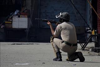
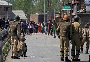
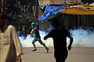
The Indian army maintains over half a million troops to control the overwhelming desire for independence among Kashmiris in the region. The Indian state is known to strictly monitor all printed maps of the valley in books and other media.
Al Jazeera English in a statement released on its website Wednesday also condemned the Indian government’s decision to take the channel off air over the maps.
"The maps, produced by an external software, gave the same treatment to Indian-controlled Kashmir, though this was not subject to similar complaints," the statement said.
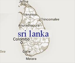
Kashmir, a Muslim-majority Himalayan region, is held by India and Pakistan in parts and claimed by both in full.
The two countries have fought three wars -- in 1948, 1965 and 1971 -- since they were partitioned in 1947, two of which were fought over Kashmir.
Since 1989, Kashmiri resistance groups in Indian-held Kashmir have been fighting against Indian rule for independence, or for unification with neighboring Pakistan.
More than 70,000 people have reportedly been killed in the conflict so far.