Turkish Arctic expedition team conducts atmospheric, oceanic observations
Automatic meteorological observation station installed for 1st time on expedition vessel to provide periodic data from Arctic to Antarctica throughout journey
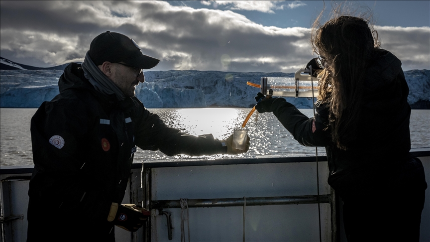
 Turkish Student Elif Berra Demir is seen conducting her research during the 5th National Arctic Scientific Research Expedition near Svalbard and Jan Mayen on July 9, 2025. During the 5th National Arctic Scientific Research Expedition, conducted under the auspices of the Turkish Presidency, the responsibility of the Turkish Industry and Technology Ministry, and the coordination of the TUBITAK MAM Polar Research Institute, scientists sought answers to questions about the future of the planet with 19 different marine projects in the Arctic region.
SVALBARD
Scientists from Türkiye’s fifth expedition to the Arctic region conducted atmospheric and oceanic observations and recorded readings from the area throughout the voyage via an automatic, meteorological observation station established for the first time on the interpolar line.
The water vapor in the atmosphere and the interactions between the atmosphere and the ocean were analyzed using Global Navigation Satellite Signals (GNSS), while physical and chemical changes in different glacier regions were observed via water and ice samples.
To provide key data on climate change and sea level changes, oceanographic measurements were analyzed during the expedition.
Erhan Arslan, deputy leader of the expedition, told Anadolu that the team installed an automatic observation station on the ship to measure meteorological parameters at different points, from the Arctic to Antarctica.
Arslan stated that the data will be used to determine measurements for future expeditions and improve them.
“The project for modeling the relationship between the atmosphere and the amount of water in an atmospheric column using GNSS signals is a key step in calculating water vapors and other gases,” he noted, adding that the key data will enable a better understanding of climate change.
Adil Enis Arslan, a researcher participating in the expedition, told Anadolu that high-density and high-accuracy GNSS measurements at one-second intervals were conducted to examine the relationship between the atmosphere and the ocean.
Arslan noted that water and ice samples collected will be used for two projects to be conducted at Istanbul Technical University to determine the effects of global warming.
“These periodic observations will provide us with a data set to draw upon when making estimates between the same regions,” he said.
Lieutenant Mustafa Kanat from the Directorate of Navigation, Hydrography and Oceanography (SHOD) told Anadolu that the expedition provided necessary calculations to determine the seabed and the depth using multi-beam echo sounder systems, while using remote sensing systems and satellite-based bathymetric measurements to take transparency readings.
“This enables us to determine how deep a signal can reach from a satellite or an unmanned aerial vehicle based on its frequency spectrum,” he said.


