ANKARA
The latest monsoon rains, which are wreaking havoc in South Asian countries of Afghanistan, Pakistan, and India, have once again highlighted the need for cooperation and evolving a joint mechanism to tackle natural disasters, which transcend political boundaries.
Pakistan has been the worst hit by floods in recent memory affecting 33 million people – almost 15% of the country’s population – and reporting 1,500 deaths so far as per the National Disaster Management Authority. The nearby Taliban-controlled Afghanistan has also witnessed 182 deaths with more than 3,000 houses damaged. India has also reported 40 deaths due to floods with even the desert state Rajasthan bordering Pakistan reporting heavy downpours leading to submerging of villages and towns.
According to Islamabad-based political analyst Ershad Mehmood, Pakistan has witnessed 173 natural disasters in the past two decades.
Between 2000 and 2019, India also experienced 321 incidents of national disasters affecting 1.08 billion people, as per the figures available with the UN Office for Disaster Risk Reduction.
Right now, while the focus should remain on rescue operations, it is equally imperative for both the countries in the region to take lessons and evolve a common approach to sort out environmental issues related to climate change which are leading to frequent disasters.
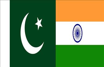
Rivers causing floods in Pakistan originate from neighboring countries. While the Kabul River flows from Afghanistan, three other rivers Ravi, Beas, and Satluj originate in India. Other rivers Indus, Jhelum, and Chenab flow into Pakistan from Indian-administered Jammu and Kashmir.
As per a river water sharing agreement, the Indus Water Treaty (IWT), arranged and negotiated by the World Bank in 1960, three "eastern rivers" — the Beas, Ravi, and Sutlej with a mean annual flow of 33 million acre-feet (MAF) — have been given to India. The control over the waters of the three "western rivers" — the Indus, Chenab, and Jhelum with a mean annual flow of 80 MAF — have been assigned to Pakistan with no commitment to sharing resources to manage the health of these rivers.
Even as the treaty has focused on water distribution, it has hardly set rules for managing the condition of the rivers or setting up a joint mechanism to stop floods. India’s Central Water Commission (CWC), which has flood-monitoring systems on all rivers in the country, does not possess a similar mechanism for the three western rivers, as they are governed by the Pakistan-India Permanent Indus Commission, which has a mandate limited to monitor the flow of the waters.
Satellite-mounted flood mechanism
Since the waters of western rivers are harvested by the farmers in the Pakistani heartland, there is no incentive left for the Indian side to either invest in the flood-monitoring mechanism or any other project related to the development of rivers.
Though the latest satellite-mounted systems may not prevent floods, the warnings have been helpful over the past many years for saving lives.
After the 2004 Tsunami that swept the Indian Ocean, leaving 227,898 dead, the warning systems established in the coastal areas since then have succeeded in saving lives. In 2019, thousands of lives in India’s coastal state of Odisha were saved from the Fani cyclone, because of advance 24-hour notice. Relocation of 1.2 million people to safer places limited deaths to just 32. In contrast, a cyclone in 2016 with a lesser intensity killed 10,000 people in the same region.
Scientists have been often warning that the melting of Himalayan glaciers at an alarming rate is making downstream areas flood-prone. Nearly 15,000 Himalayan glaciers form a unique reservoir that supports perennial rivers such as the Indus, the Ganges, the Brahmaputra, and the Mekong, which are the main sources of fresh water for billions of people in the South and Southeast Asian region.
Back in 1893, British Surveyor General Walter Lawrence mentioned that it was not just torrential rains, but the melting of snow peaks that often causes floods in the region. It has been noted that among all the Himalayan glaciers, the ones located in Kashmir and those which feed the Indus water system are receding fast.
The nose of the Kolahoi Glacier in Kashmir, one of the largest glaciers in the Himalayas, was found to have receded almost 22 meters (72 feet) in around two decades when mapped last time in 2007. Several smaller adjacent glaciers were found to have disappeared completely due to extraordinary human activity. Instead of limiting such activity, governments often encourage the flow of tourists, and in the case of Kashmir the visit of Hindu pilgrims to the upper reaches of the Himalayas to pay obeisance to a cave shrine Shri Amarnath in the Pahalgam mountains in South Kashmir.
Authorities in Jammu and Kashmir this year were expecting 700,000 pilgrims to visit this cave shrine and have set a target of 1 million over the next few years. However, due to many factors this year only 350,000 pilgrims visited the region despite allurements.
Receding snow lines
Barely 20 years ago, the snow line to the Kashmir valley's east was just above areas like Pahalgam and Sonmarg -- 3,200 meters (10,499 ft). Currently, the line has receded to the Shiashnag area which is at an altitude of 5,000 meters. The same is true of the Pir Panjal mountain range in the west where the snow line was above Kongwatan and Zaznar (3,000-3,500 meters).
Most of the glaciers from Harmuk to Drungdrung have significantly receded.
Fifty years ago, the Chenab basin used to have about 8,000 square kilometers (3,088 square miles) under glaciers, permanent and ephemeral snow cover, as compared to the present 4,100 sq km. The Pir Panjal range hardly has any glaciers at present.
"Currently the line has receded to the Shiashnag area which is at an altitude of 5,000 m (16,404 ft) only. The same is true of the Pirpanjal mountain range in the west where the snow line was above Kongwatan and Zaznar (at an altitude of) 3,000-3,500 m (9,842-13,123 ft),” said a report by ActionAid, a global federation working on issues related to climate change, and poverty.
In 1996, a parliamentary panel led by Nitish Sengupta sought regulations to bring down the footfall of tourists and pilgrims to preserve the region's fragile ecology and environment. It is interesting to note that the Hindu nationalist Bharatiya Janata Party (BJP) government in the Himalayan Uttarakhand state applied recommendations of Sengupta's report in Gangotri in 2008 by restricting the number of pilgrims and tourists to 150 a day at Gomukh, the origin of the Ganges, the holy Hindu shrine.
Many countries have regulated tourist inflows into their mountainous regions. India's national environment policy also calls for measures "to regulate tourist inflows into mountain regions to ensure that these remain within the carrying capacity of the mountain ecology."
Barring certain water bodies that are spring-fed, most of the streams of the Indus water system are glacier-fed. Since early melting triggers massive discharge in rivers, the water bodies lack the adequate quantity later once the agricultural activity begins leading to droughts.
The capital of Indian-administered Kashmir Srinagar was labeled as Venice of the East, because of the elaborate network of canals. In the city, the main channel of transportation was a water body called Nallah Maar. But in 1977, it was filled up and a paved road replaced the stream, which used to also work as a flood channel for River Jhelum.
Mutilating geography
The story of mutilating the geography – a ready invitation to floods and disasters – is repeated everywhere in South Asia, where old canals and streams have been paved, giving way to constructions.
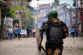
No doubt terrorism poses a threat to countries, but the current floods in Pakistan, India, and Afghanistan and earlier inundation of Kashmir Valley in 2014 because of incessant rains and melting of snow have once again proved that climate change is a greater threat to humanity with far-reaching consequences. The impact of disasters is long-lasting and affects generations.
There is time for South Asian countries to sit together and find a solution to this threat. A mechanism can be set up under the eight-member South Asian Association of Regional Cooperation (SAARC) or the Shanghai Cooperation Organization (SCO). Since the SCO is meeting in the Uzbek city of Samarkand from Sept. 15-16, the leaders need to attend to this issue on priority to save human lives from frequent disasters in the region.
*Opinions expressed in this article are the author's own and do not necessarily reflect the editorial policy of Anadolu Agency.