The UN will promote world maps showing countries and continents at more accurate relative sizes
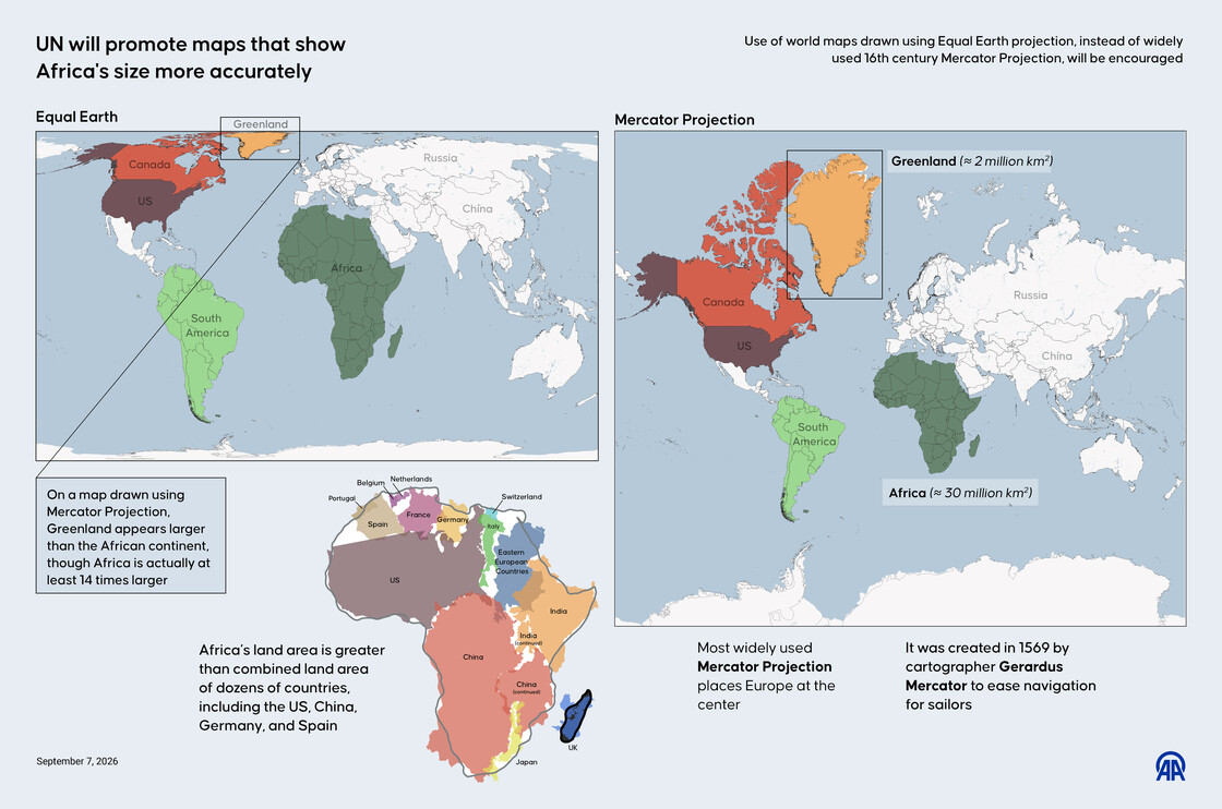
► The most widely used Mercator projection places Europe at the center, which was created in 1569 by cartographer Gerardus Mercator to ease navigation for sailors
► In a map drawn using the Mercator projection, Africa's actual land area is dramatically understated, even though it is larger than the combined land area of dozens of countries, including the US, China, Germany, and Spain
► Greenland also appears larger than the African continent on these maps, even though Africa is actually at least 14 times larger
► The "Correct the Map" resolution promotes the Equal Earth projection to address the distortions found in widely used Mercator maps
► The African Union previously endorsed the "Correct the Map" initiative, arguing that the Mercator projection has contributed to misconceptions about Africa’s geographical scale